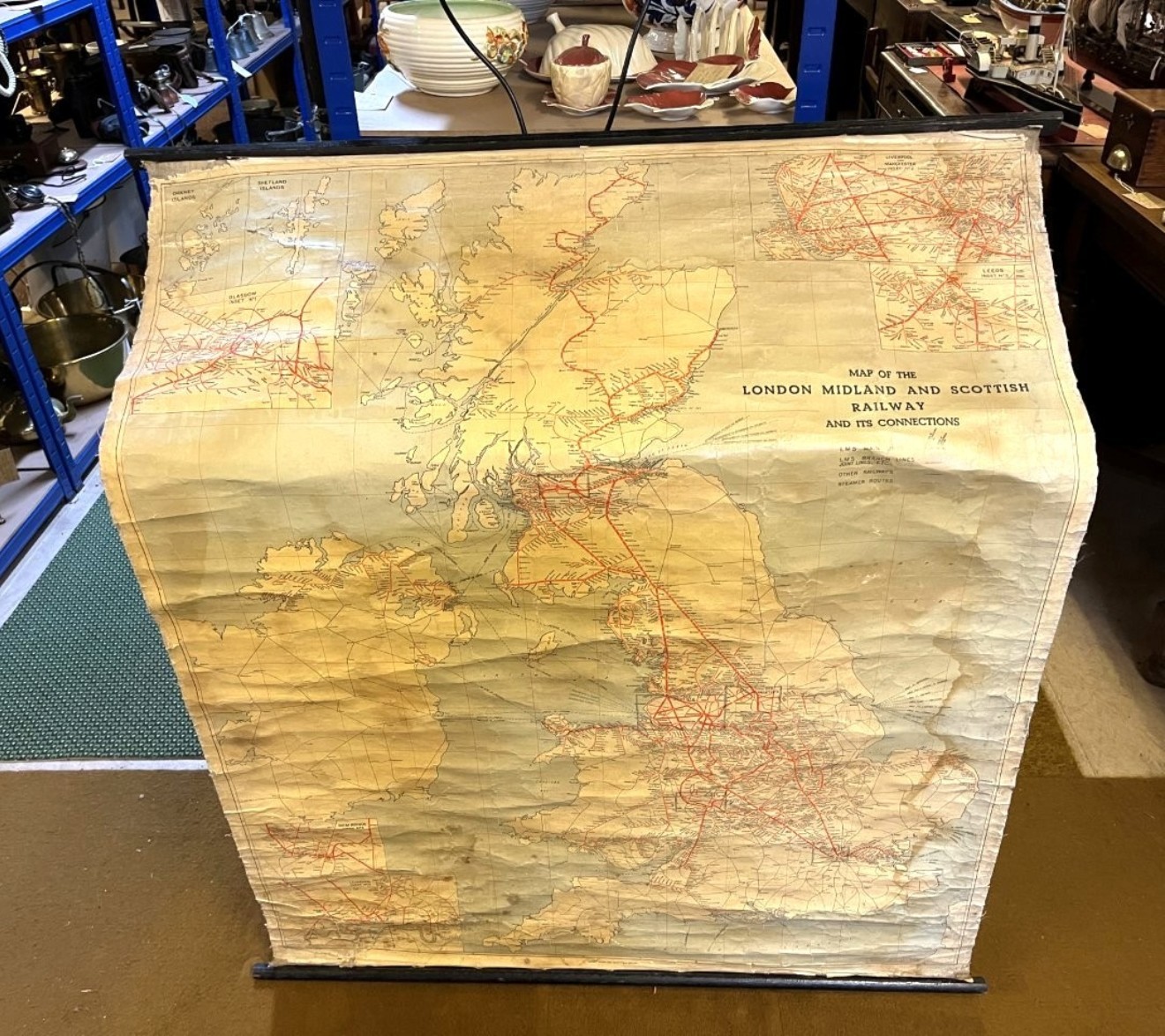
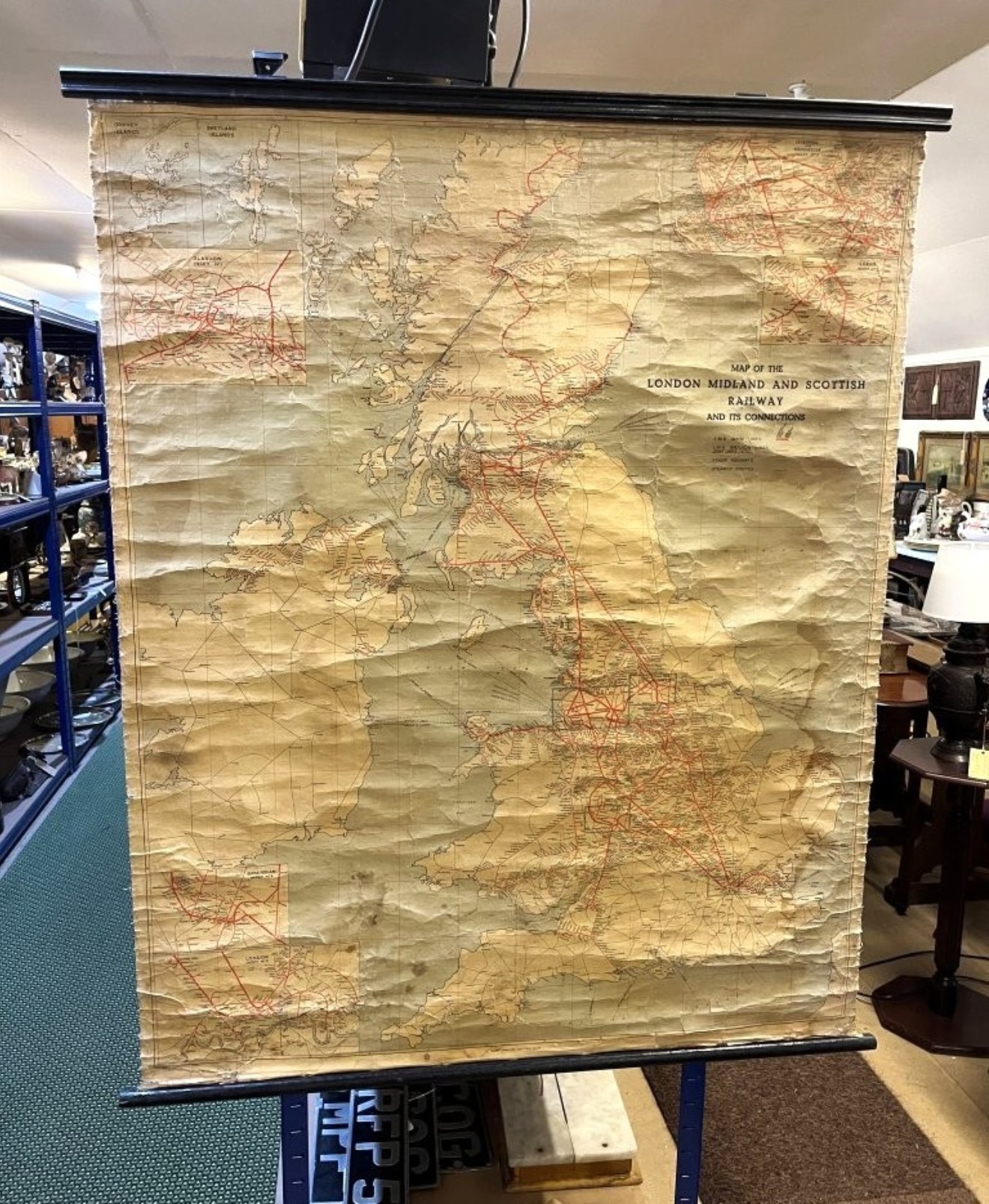
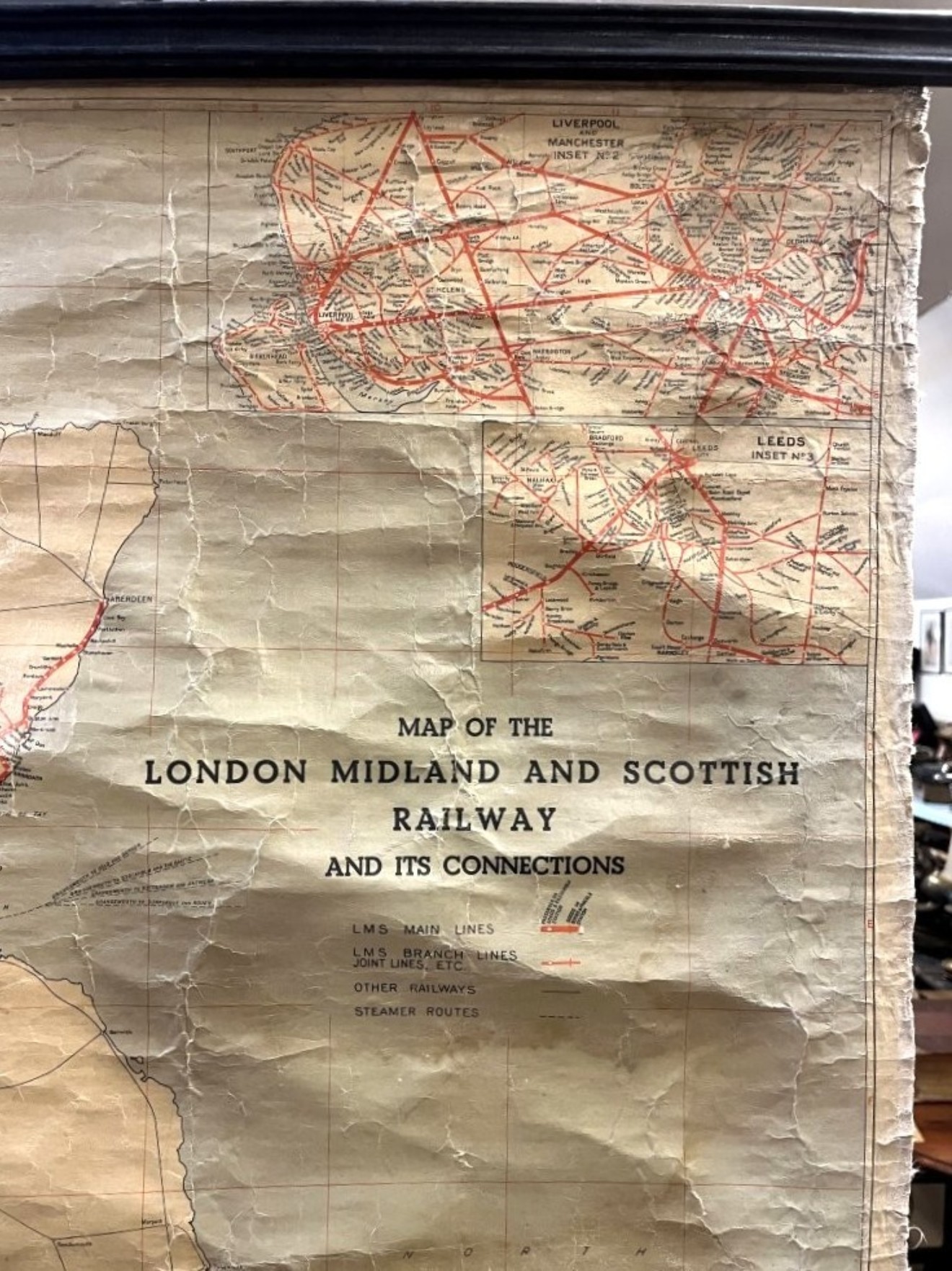
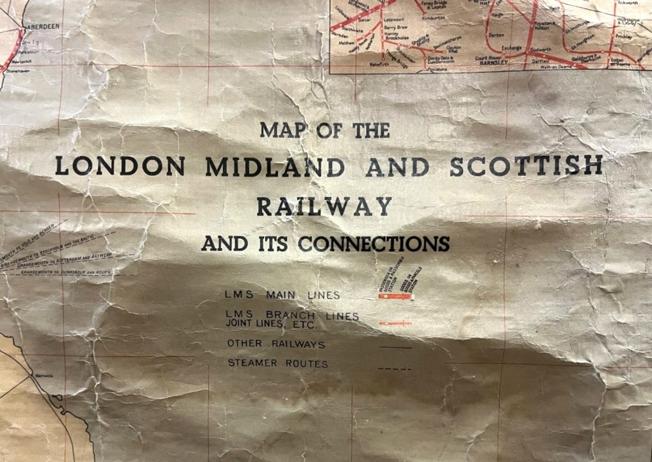
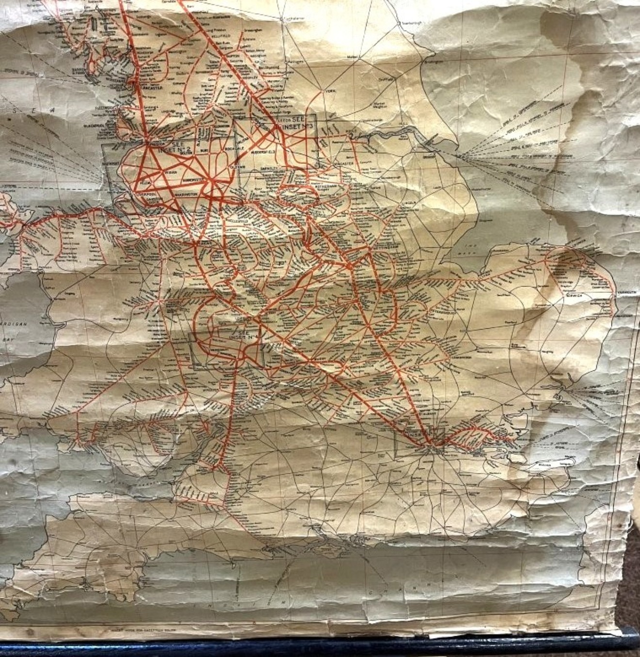
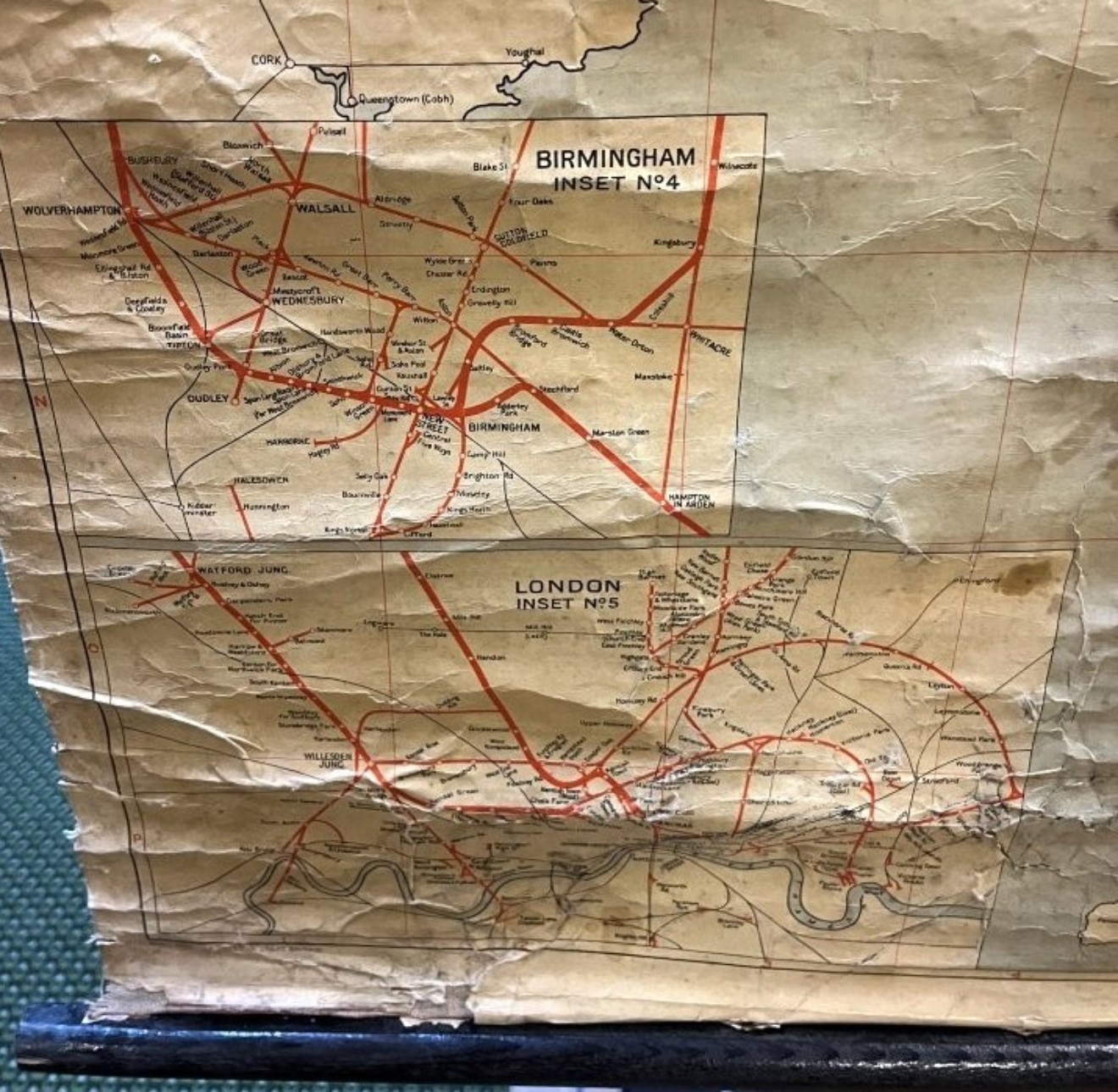
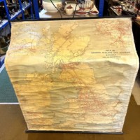
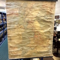
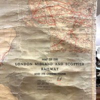
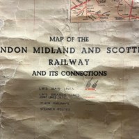


Vintage Map of the London Midland and Scottish Railway and its Connections Printed in 1939
£55
Item Code: 176
Vintage Map of the London Midland and Scottish Railway and its Connections Printed in 1939
Pull Down Wall Map Printed on a Slight Sheen Finish Canvas with Cream and Pale Blue Background Hanging Poles at the Top and Bottom
Some marking reflected in price
Dimensions:
50" high x 41" wide (1280mm x 1050mm)